Scripps Institution of Oceanography
Center for Marine Biodiversity and Conservation
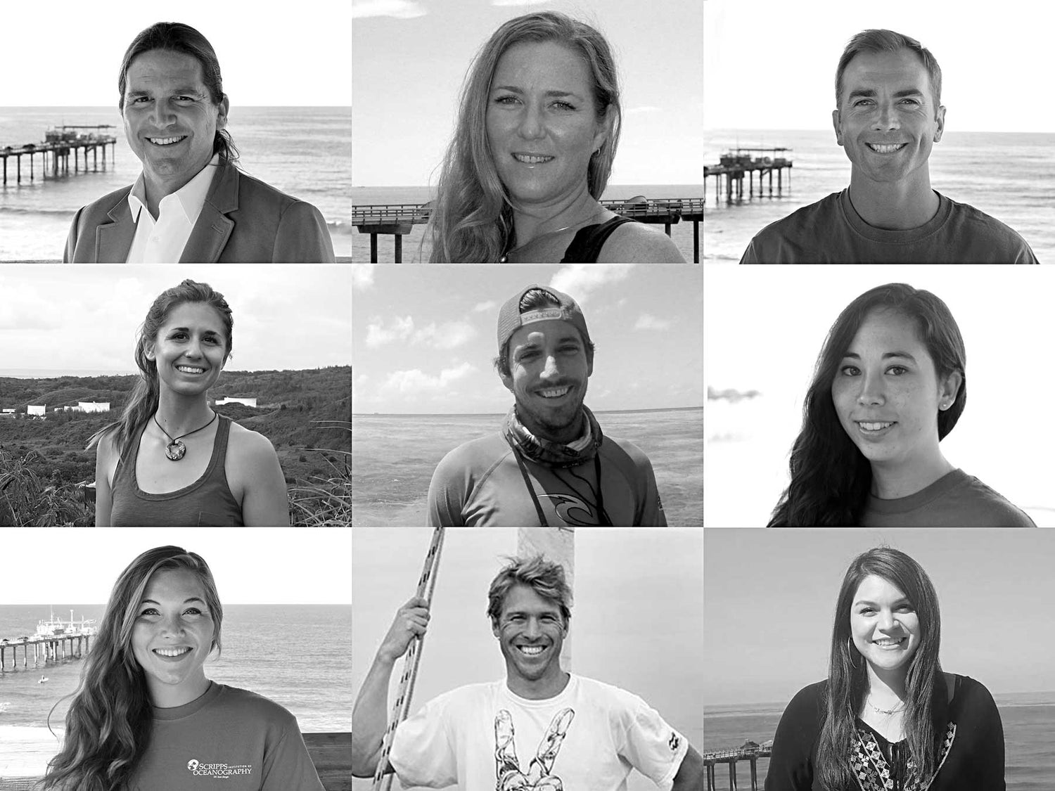
Top Row (left to right):
Dr. Stuart Sandin, Professor, Co-Pl of 100 Island ChallengeDr. Jennifer Smith, Professor, Co-Pl of 100 Island Challenge
Dr. Brian Zgliczynski, Postdoctoral Researcher, Project Coordinator of 100 Island Challenge
Middle Row (left to right):
Lindsay Bonito, Staff ResearcherChris Sullivan, Staff Researcher
Nicole Pedersen, Staff Researcher
Bottom Row (left to right):
Samantha Clements, Staff ResearcherClinton Edwards, PhD Student
Esmerelda Alcantar, Staff Researcher
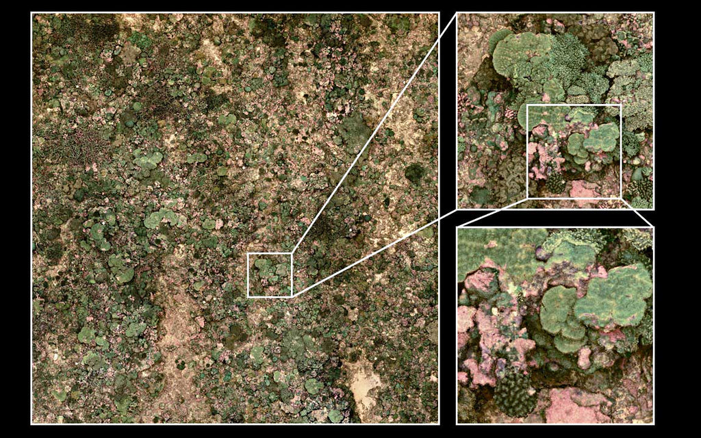
The team's surveys generate super detailed imaging of vast swaths of coral reefs. The level of detail is accomplished by taking thousands of pictures and stitching them together. Each site is surveyed multiple times with 1-2 years in between.
Watching coral reefs change through time, pixel by pixel
Conducting science outdoors is challenging, but completing work underwater is nearly impossible. While our colleagues in the fields of forestry or ornithology can work from dawn to dusk collecting data, we are constrained by the limits of SCUBA tables. Cameras, however, empower us to learn more about the underwater world by helping us to collect raw image information that we can study for days, weeks, and years to come.
Stuart Sandin and his team (professors, graduate students, postdoctoral researchers and staff researchers) have been depending upon Ikelite housings to expand their science for over a decade. The underwater imagery began with 1000s of hours of video recordings of predation on fish in the Caribbean (using Sony DCR‑TRV900 video cameras and a bulletproof custom Ikelite housing). Today the group has moved on to creating 3-dimensional mosaics of entire coral reefs (using a collection of Nikon D7000s protected by Ikelite). The images are essential to our research and invaluable for sharing the science with the public through the visuals that only nature can produce.
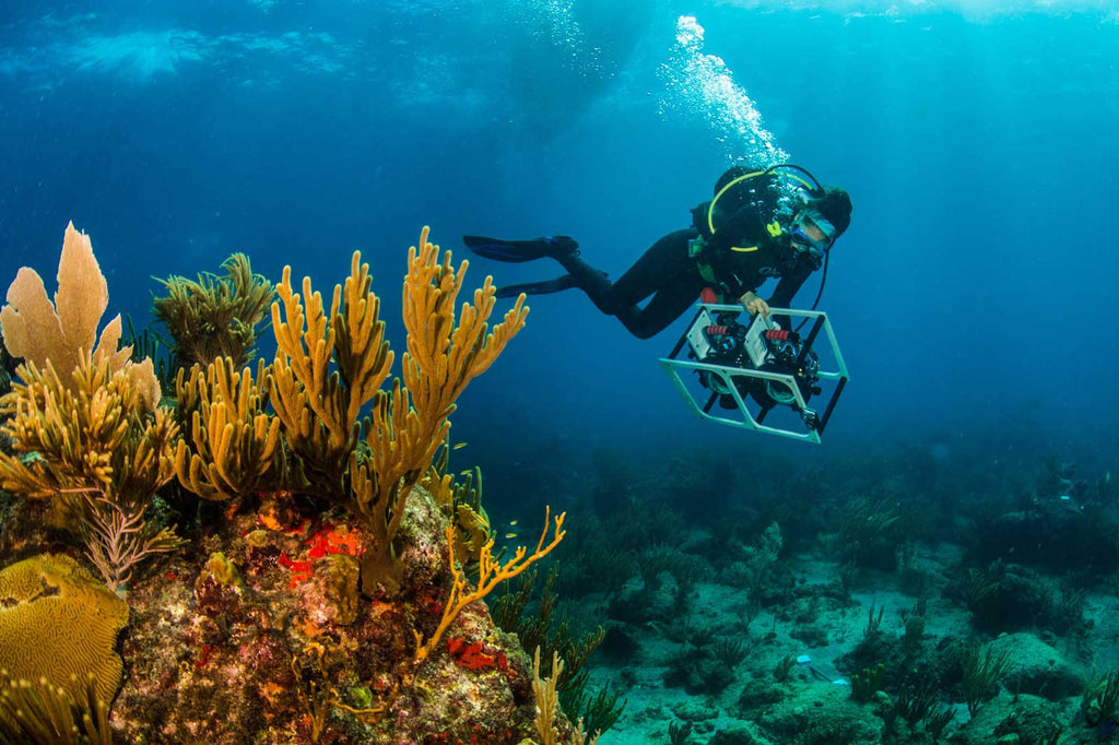
Nicole Pedersen collecting imagery in St. Eustatius, an island in the Dutch Caribbean. Photo Credit: Ralph Pace
The Sandin lab and their colleagues, including our technical partners at UC San Diego developing state-of-the-art software to visualize this imagery, have embarked on their next big campaign, the 100 Island Challenge. Armed with cameras and dive gear, they are visiting 100 tropical islands across the globe to document that structure of coral reefs and to track how they change. This campaign is providing a detailed view of coral reef ecology, as we photograph the same exact locations year in and year out, allowing us to literally watch the reef grow. The field of environmental imaging is providing explosive potential for us to learn about how the world works, especially as we explore the depths and furthest reaches of the underwater world. Of course, this work would not be possible without the many partnerships and collaborations globally with local community groups, non-profit agencies, government divisions, and research institutions to expand the scientific insights into the state and future of their reef areas.
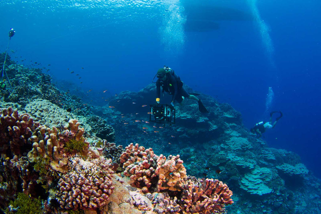
Chris Sullivan imaging a reef in the Tuamotus Archipelago in French Polynesia. Photo Credit: Brian Zgliczynski
Achievements
- Creating large-scale imagery of coral reefs worldwide, including 3D models of reef landscapes.
- Featured in numerous press releases (New York Times, BBC Earth, Earth Magazine, San Diego Union Tribune, Surfline, Surfers Village, Australian Broadcasting Corporation, Inertia, Korduroy TV, PBS-Miami).
- Images included in countless academic settings, teaching materials, textbooks, and scientific journals.
- Trainings and donations of photogrammetry equipment to local monitoring and conservation groups globally.

Tetepare reef. Tetepare Island is the largest uninhabited island in the South Pacific, located in the Western Province of the Solomon Islands.
